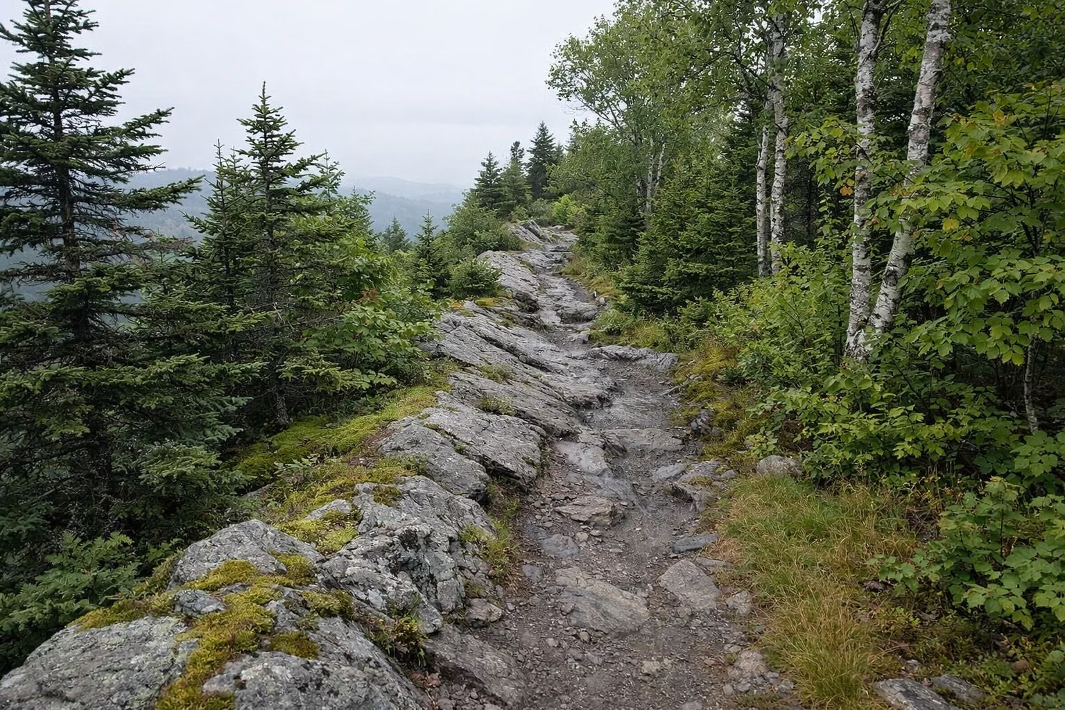
Appalachian Trail on Mount Greylock
The Appalachian Trail crosses the summit of Mount Greylock, the highest point on the AT in Massachusetts at 3,491 feet. 11.5 miles of the trail run through Mount Greylock State Reservation, part of the 90 miles DCR counts in Massachusetts. Look for white blazes. An AT climb to the summit from Notch Road is 3.2 miles from Wilbur's Clearing on Notch Road.
Day hikers use the AT for most summit routes. Thru-hikers and section hikers walk the whole ridge, past Bascom Lodge on top.
The AT at a Glance
The AT in Massachusetts
DCR describes the Appalachian Trail as 2,175 miles from Georgia to Maine, with 90 of those miles in Massachusetts. It runs from Mount Everett in the south of the state to Mount Greylock in the north. Since Greylock is the highest point in Massachusetts, it's the highest point on the trail in the state.
Hiking the AT South to North Over Greylock
DCR's mileage sheet gives AT distances from both ends of the reservation.
- From Outlook Avenue, Cheshire, heading north: Old Adams Road at 2.7 miles (moderate), Jones Nose Trail at 4.2 miles (strenuous), the summit at 6.8 miles (aggressive).
- From Pattison Road, North Adams, heading south: the Mount Prospect Trail junction at 1.9 miles, Mount Williams summit at 3.1 miles, Greylock summit at 5.4 miles. All rated aggressive.
- From Wilbur's Clearing on Notch Road: 3.2 miles south to the summit, strenuous.
Day Hikes That Use the AT
- Wilbur's Clearing to Summit: 6.9 miles round trip, 4.5 to 5 hours. Out on the AT along the ridge, back on part of the old 1860 carriage road. Seasonal trailhead.
- Jones Nose to Summit: 8.5 miles round trip, 2.9 miles of it on the AT through boreal forest. Seasonal.
- Summit Hike from the Campground Parking Lot: 6.2 miles round trip, the last 1.1 miles on the AT. Seasonal.
- Cheshire Harbor Trail: 3.3 miles each way, the last 0.7 miles on the AT. Year-round.
- Greylock in the Round: 13 miles, including 3.75 miles of AT from the Money Brook Trail junction to the summit, with an optional side trip to the Mount Prospect view.
Full details are in our hiking guide.
Robinson's Point
From the summit, the AT heading north reaches the Robinson's Point vista in 0.8 miles. DCR rates it strenuous. From Notch Road the vista is only 0.2 miles.
Water and Supplies on Top
Drinking water is available behind Bascom Lodge on the summit from late May through October, and at the visitor center year-round. Treat any water you take from a stream. Bascom Lodge serves food in season and has rooms.
Shelters and Overnight Stays
DCR has five lean-to shelters in the reservation, free and first come, first served, year-round: Deer Hill, Wilbur's Clearing, Bellows Pipe, Peck's Brook and Mark Noepel. Each site takes up to 12 people. Camping is only allowed at shelters and the campground.
Register an overnight trip with park staff at (413) 499-4262. For AT camping across the state, DCR points hikers to the Appalachian Mountain Club's western Massachusetts chapter.
Parking for AT Hikers
Overnight parking is allowed year-round at the visitor center and the Hopper Road lot in Williamstown, and from late May to October at the summit and the campground lot on Rockwell Road. Day hikers can use the Wilbur's Clearing and Jones Nose lots while the auto road is open. See parking.
Rules on the AT Here
- Dogs on a leash no longer than 10 feet, with proof of rabies vaccination.
- The AT is a hiking-only footpath. Stay on designated trails.
- Wear blaze orange in hunting season (any time outside May 20 to Columbus Day). See rules.
- Carry out all trash.
Distances are from DCR's trail mileage sheet. The DCR park page posts closures.
Appalachian Trail FAQ
Does the Appalachian Trail go over Mount Greylock?
Yes. The AT crosses the 3,491-foot summit, and 11.5 miles of it run through Mount Greylock State Reservation. It's marked with white blazes.
How many miles of the Appalachian Trail are in Massachusetts?
90 miles, according to DCR, from Mount Everett in the south to Mount Greylock in the north.
What is the highest point on the Appalachian Trail in Massachusetts?
The summit of Mount Greylock, at 3,491 feet. It's also the highest point in the state.
Where can AT hikers stay on Mount Greylock?
At five free first-come lean-to shelters (Deer Hill, Wilbur's Clearing, Bellows Pipe, Peck's Brook and Mark Noepel), at Sperry Road Campground by reservation in summer, or at Bascom Lodge on the summit in season.
Facts from the DCR page for Mount Greylock State Reservation.