Parking at Mount Greylock is free at the visitor center, 30 Rockwell Road, Lanesborough, MA 01237, and DCR's 2026 fee schedule doesn't list a day-use fee for the reservation. The one charge DCR mentions is at the summit lot, where its trail mileage sheet says a $2 parking fee applies. The summit lot is only reachable while the auto road is open, May 16 through October 30, 2026.
Trailhead lots ring the mountain in six towns. Which one you want depends on the hike. Below is every lot DCR lists, with its address and what it's for.
At a Glance
Parking at a Glance
Visitor center30 Rockwell Road, Lanesborough, MA 01237
Visitor center parkingFree, all vehicles, year-round
Summit lotSeasonal; DCR notes a $2 fee
Trailhead lotsNo fee listed by DCR
Summit roadMay 16 through October 30, 2026
Vehicle limit (roads)22 feet
Overnight parkingVisitor center, Hopper Road, summit, campground lot
Parking Lots
Pick a Lot, Get Directions
Visitor Center
30 Rockwell Road, Lanesborough, MA 01237
GPS 42.55346, -73.21182
Lanesborough
Free
Starts here: Visitor center, Bradley Farm Trail, Northrup Trail, Woodason Spring Trail
Get directions opens Google Maps in a new tab. Pins come from DCR's Suggested Day Hikes guide. DCR publishes no pin or street address for the summit or Money Brook Falls lots, so those cards have no button; follow the auto road signs.
Driving In
How Far Is Mount Greylock From Albany?
Road distance and drive time from the nearest big cities, with short directions from each.
Road distance and typical drive time, no traffic, to the Visitor Center lot at 30 Rockwell Road, Lanesborough
Each drive ends at the Visitor Center lot at 30 Rockwell Road, Lanesborough. Road distance and drive time from OpenStreetMap routing (OSRM), checked November 6, 2026. Drive times are typical, with no traffic.
From Albany
Starts at Albany City Hall. 37 miles, 1 hr 5 min (typical, no traffic).
Take I-787 North to Exit 5 and I-90 East over the Patroon Island Bridge.
Take Exit 8 (NY 43, Defreestville) and follow NY 43 East into Massachusetts, where it becomes Hancock Road (MA 43).
Turn right on Brodie Mountain Road, then right on US 7 (Williamstown Road).
In Lanesborough, turn left on Bailey Road and continue on North Main Street.
Bear right on Greylock Road, then left on Rockwell Road to the visitor center.
From Springfield
Starts at Springfield City Hall. 62 miles, 1 hr 37 min (typical, no traffic).
Take I-91 North about 4 miles to Exit 14, then the Massachusetts Turnpike (I-90) West about 35 miles.
Take Exit 10 (US 20, Lee, Pittsfield) and follow US 20, then US 7 and US 20, north to Pittsfield.
Follow US 7 (First Street, North Street) through Pittsfield into Lanesborough.
Turn right on North Main Street, bear right on Greylock Road, then left on Rockwell Road to the visitor center.
From Hartford
Starts at Hartford City Hall. 88 miles, 2 hr 8 min (typical, no traffic).
Take I-91 North about 31 miles to Exit 14 in Massachusetts.
Follow the Massachusetts Turnpike (I-90) West about 35 miles to Exit 10 (US 20, Lee, Pittsfield).
Follow US 20, then US 7 and US 20, north to Pittsfield, and US 7 north into Lanesborough.
Turn right on North Main Street, bear right on Greylock Road, then left on Rockwell Road to the visitor center.
Getting to the Visitor Center
Hayfield with an old stone wall and apple trees below wooded hills
Put 30 Rockwell Road, Lanesborough, MA 01237 into your map. The visitor center is at the south end of the reservation, at the bottom of Rockwell Road, and is the main orientation stop. DCR says the summit is 8 miles farther up the road. The visitor center lot is open to all vehicles, including those too long for the summit road.
Is There a Parking Fee?
Visitor center: free, per DCR's visitor centers page.
Summit: DCR's trail mileage sheet mentions a $2 parking fee at the summit lot (in its note on overnight parking), and the National Park Service's summit page says a $2 fee applies at the summit lot. Check the sign there.
Trailheads: DCR's fall guide lists the Cheshire Harbor and Haley Farm trailheads as free, and Mount Greylock is not on DCR's 2026 list of parks that charge a daily fee.
Fees can change, so read the sign at the lot. DCR's fee notes say its parks don't take cash and accept Visa, MasterCard or Discover.
Summit Parking
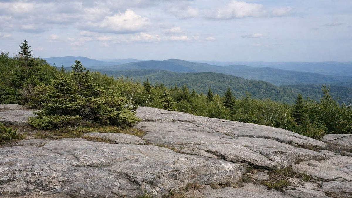
Stunted spruce and gray rock at a mountaintop clearing with hills beyond
The summit lot sits beside the Veterans War Memorial Tower and Bascom Lodge. It's open while the auto roads are, May 16 through October 30, 2026. DCR warns that on peak October weekends the roads get congested and you may wait for a space at the top. Vehicles over 22 feet can't drive up.
Year-Round Trailhead Parking
Visitor center, 30 Rockwell Road, Lanesborough: Bradley Farm loop and the Rounds Rock trek.
Haley Farm, 1136 Hopper Road, Williamstown: Money Brook Trail, Hopper Trail, Stony Ledge loops and the walk to the campground.
Roaring Brook Road, 160 Roaring Brook Rd., Williamstown: Roaring Brook and Stony Ledge. DCR says parking here is limited.
Notch Road near Reservoir Road, North Adams: Bellows Pipe Trail (Thoreau's Footsteps hike).
End of West Mountain Road, Adams (past Greylock Greenhouses): the Cheshire Harbor and Gould trails.
Seasonal Parking on the Auto Roads
Rounds Rock, Rockwell Road, Cheshire: Rounds Rock and Jones Nose loop.
Jones Nose, Rockwell Road, Cheshire: ridge hike to the summit.
Campground Parking Lot, Rockwell Road, New Ashford (mid May to November 1): Campground Trail to Sperry Road Campground and the Summit Hike.
CCC Dynamite, Rockwell Road, New Ashford: walk Sperry Road to Stony Ledge. If it's full, DCR suggests the Campground lot 1.3 miles downhill.
Wilbur's Clearing, Notch Road, North Adams: Appalachian Trail to the summit.
Money Brook Falls lot, Notch Road: the short, steep trail to the falls.
Overnight Parking
DCR allows overnight parking year-round at the visitor center and the Hopper Road lot in Williamstown. From late May to October you can also park overnight at the summit, where the $2 fee applies, and at the campground lot on Rockwell Road. Register an overnight trip with park staff at (413) 499-4262 first (see camping).
Parking Tips From DCR
Park only in designated areas. Spaces may be limited.
Don't block other cars in.
Keep valuables out of sight.
Watch for traffic crossing Rockwell Road at the CCC Dynamite and Rounds Rock trailheads.
Public Transit
DCR doesn't list public transit to the reservation, so plan on a car. During the Greylock Ramble in October, DCR's fall guide (a 2017 map) notes free shuttles from downtown Adams to the base of the Cheshire Harbor Trail.
Hours are on our hours page. The DCR park page is the source of record for fees and closures.
A small overlook parking area with a few cars and a view of hillsA gravel trailhead pullout with one car at the forest edge
FAQ
Parking FAQ
Is there a fee to park at Mount Greylock?
Parking at the visitor center is free, and Mount Greylock isn't on DCR's 2026 list of parks with a daily parking fee. DCR's trail mileage sheet and the National Park Service both mention a $2 fee at the summit lot; check the sign there.
What is the address for Mount Greylock?
The visitor center and park headquarters is at 30 Rockwell Road, Lanesborough, MA 01237. The summit is 8 miles up Rockwell Road from there.
Where do you park to hike Mount Greylock?
For the Cheshire Harbor Trail, park at the end of West Mountain Road in Adams. Other year-round lots are at the visitor center in Lanesborough, Hopper Road and Roaring Brook Road in Williamstown, Notch Road in North Adams and Gould Road in Adams.
Can you park overnight at Mount Greylock?
Yes, year-round at the visitor center and the Hopper Road lot in Williamstown, and from late May to October at the summit and the campground lot on Rockwell Road. Register with park staff at (413) 499-4262.